Showing posts with label Hill Walking. Show all posts

Friday, December 10, 2010

Fairfield Horseshoe

I've been mixing it up a bit with my activities since the cold snap. As I'm no fan of ice (I might have mentioned this before) I've not been keen on taking a bike out. I decided to just do some things I don't normally do so hour long sessions on the turbo doing intervals, a bit of running, some winter hillwalking and even back into the gym to primarily do some weights but also a bit of rowing.

I've been quite enjoying it but I'd had enough of being indoors and last Saturday afternoon saw me head out to Abbey Village in the pouring rain to go for a run. I fully expected it to be sleet higher up and normally I'd be totally meh about running in it. I wasn't sure how far I would get and took my microspikes with me. I didn't need them on the way up as the wet slush got progressively more snowy as I climbed. I had the moor almost entirely to myself which is very rare even for a dull, cold Saturday afternoon. I saw only one other person at the Tower.

I put my spikes on for the descending as the slush was compacting under my shoes and causing traction issues. Legs were a bit tired on the last trog back to the car and it was pretty much dark by the time I got there, damn these short winter days. Just over 8 miles which is the longest run for quite some time no wonder my legs felt a bit battered.

Sunday saw us head up early doors to the Lakes due to a good forecast, the Fairfield Horseshoe was the plan. I figured it would be well tracked for good progress. The drive up was a bit sketchy, lots of ice on even the main roads, there was more snow in the Lakes than I thought.

Parked up in Ambleside to a balmy -6, quick kit then set off to do the walk clockwise with the boring trog to Rydal first. A while later trog back again as forgot to get parking ticket...find its free parking anyway. Grr. Head off again but this time anti-clockwise to just get up on the hill. The trog from Rydal will be easy in the dark if necessary.

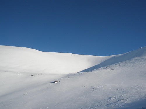
Beautiful blue sky, white snow, mist on the lakes, stunning:

Bluest of Blue Sky

IMG_0027

IMG_0041

Crampons weren't necessary but I did have my axe out for a bit of support for big step ups with my short legs though I think, for the first time ever when walking, poles would have been really helpful for me as the axe is a little short.

Didn't seem to take long to get to the summit of Fairfield. I think I've been on it about four times and this is the first time its been free of clag. We didn't linger really and I remembered that the last time I did this walk it seemed to take an age to do this side of it.

It didn't disappoint! It seemed to trog on forever, my legs were a bit pasted to be honest, as were Jez's. Though unlike him I'm not prone to cramp so was having a slightly easier time of it. We realise now that neither of us had eaten enough, we only had one butty and one Lebkuchen each (which didn't go rock hard in the cold, recommended!) quite early on, but we got into that push on mindset.

The last descent was most amusing, lost of judicious application of the ice axe and to be honest would have been better with a pole or even putting crampons on but the adrenalin did make me forget my legs hurt. Considering how much of an ice wuss I am I actually quite impressed myself with my "just about controlled" sliding.

Last hike back to Ambleside was a pain filled nightmare and freezing, was warmer up on the hill as the sun got to it.

IMG_0067


We got back to the car about 15:45 and decided just to get straight off due to the state of the roads on the drive up. I don't think I've ever left Ambleside without going for a wander round the gear shops. Great walk though my legs took two days to get over the weekend.

Thursday, March 11, 2010

The Cairngorms

I've been back from the Cairngorms for almost a week now, a bit of a sniffle and post holiday blahs this week and it all seems a world away now.

I could write loads about the experience but I won't, it was just utterly fantastic. The snow was simply amazing. We had a pretty painless drive up on the Sunday, avoiding the worst section of the A9 it would seem by coming up from the Edinburgh side. Managed to drive past the turn off for Glenmore Lodge as the sign was totally obscured by snow. Heading up the ski road was entertaining, the road hadn't been ploughed, it had had to have a snow blower to cut through it. There is a four metre high wall of snow near the Coire Cas car park.
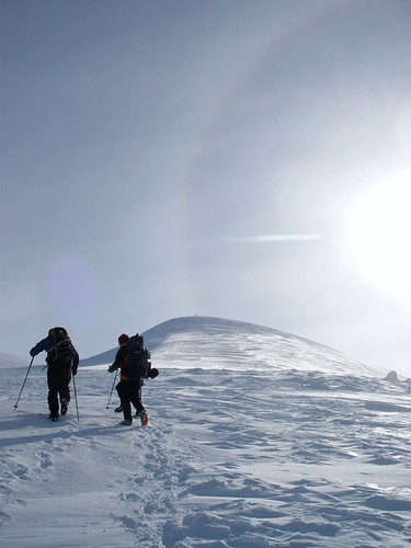
Days 1 -4 had pretty much no wind, which is quite frankly rare in the Cairngorms. We also had lots of sunshine and blue skies, again rare. I just hope I haven't had my lifetime's quota of good Scottish winter weather in one week. Soft snow meant slow moving progress particularly being the shortest member of the group, with the shortest stride. It wasn't always easy following others footsteps and as I took a lot of photos I spent a lot of time as the tail end Charlie.

On the Tuesday we were accompanied for the day by cameraman from the Adventure Show, they are doing a piece on people beginning to venture out into the Scottish hills in winter. It was quite odd doing stuff and then having a camera watching or being asked questions. Its only shown in Scotland and probably won't be out til the autumn so I'll have forgotten all about it by then. I will no doubt look and sound like a complete plank!

Ice axe arrest practice was hilarious, crampons and ice axes were seriously confidence inspiring though there wasn't always a massive need for them due to the soft snow. Snow shelter digging was interesting but quite frankly I think I'd rather bust a gut to get off the hill. A snow hole on the other hand might be fun for a night. Avalanche awareness was a hot topic for obvious reasons, lots of attention to the forecasts, looking for wind scoured slopes etc, learning new words for snow....loaded:


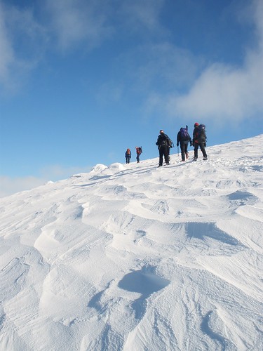
Sastrugi, my favourite word for snow:


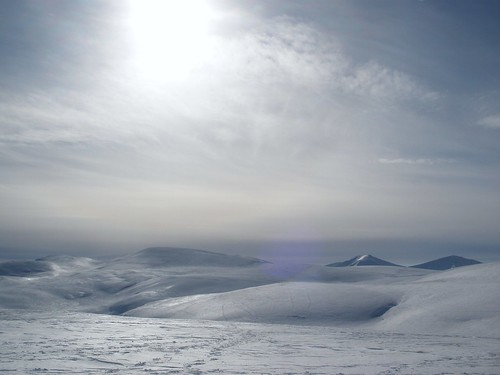
A good walk around the Northern Corries on the Wednesday with visibility for miles in every direction, not sure if I'll see it like that ever again:


Lots more photos on Flickr if you want to trawl through them.

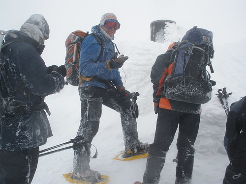
Just to redress the balance the normal weather closed in on Friday. We wanted some experience of trying to navigate in white out conditions and we got it. Snow shoes and following the pistes up made for fast progress up to Cairn Gorm summit. Sheltering in the Ptarmigan ski station for some food and layer rearrange it was then up to the summit, walking on bearings in pairs using dark patches in the snow to sight off - it was the only detail and using hand signals to correct the lead (voice signals drowned out by the wind). The view from Cairn Gorm summit, the little grey "sighting" patches visible at the bottom:


From the summit over to another feature on a bearing taken and measured by me (gulp) but it worked. I was the lead of our pair, we managed to stay on bearing and I managed to keep counting paces. I found it was a good way of blocking out thinking about the conditions. I had my only real "I'm not liking this" moment across here as everytime I had to turn back to check I was still on bearing I got a load of icy snow driven into my eyeballs, not pleasant.

Still, we found the little tor we were looking for, walking round it I got blown off my feet three times due to the combination of 40mph winds, soft, deep snow and snow shoes. Hiding behind the tor on quite frankly, dodgy windslab (just as well it was flat) I managed to get my ski goggles on and what a difference. Eyes protected, hood up, in my own bright yellow bubble it made a huge difference to things.

We set off back to the Ptarmigan with more bearing walking and pace counting and I was by then really enjoying the challenge. The only slight annoyance was having to carry my walking poles to use the compass and they kept icing to my gloves and making whatever hand was holding them freezing. The compass base plate was ice, all toggles etc were covered in rime ice, jacket hoods etc. It was a good reminder of exactly how serious things can get up there.


Monday, January 11, 2010

Pendle Hill Plod

Jez and I headed out on Saturday for a bit of a bimble on Pendle hill rather than bother with bikes, neither of us had been up it for years so I was looking forward to it. The forecast originally was for a nice morning but clouding over/potential sleet etc in the afternoon.

The M65 was slushy in places and the roads up and down into Barley were interesting to say the least. Keeping an eye on the weather was high on the agenda, getting out of Barley could prove challenging otherwise.

I think there was only another couple of cars in the car park when we set off up the obvious track, aiming for the trig point. Glorious blue sky and crisp white snow:


As it turned out we were pretty sheltered, getting up on top there was a fierce and bitter wind though luckily our choice of route meant it was to our backs as we headed to the trig point.


I had completely forgotten exactly how much of a hill Pendle actually is and as a runner overtook us I made a note to come up here and run, hopefully soon. Snow was quite firm underfoot on the top. As the cloud seemed to be building we decided to start generally heading down via Ogden Clough, given the strength of the wind I didn't fancy being up there if precipitation started and visibility dropped.


As it was we chose to ignore the obvious cairns indicating the way and trundled about on the fell for a while in remarkably shallow snow, a quick check of the map and spotting someone else heading the way we were supposed to. A quick yomp across increasingly deeper snow, I think I may have fallen over once we get back on track and catch up with another walker who knew Pendle rather well and gave us lots of information on potential routes around the hill.


The wind was whipping loose snow crystals across the top of the fell, to who knows where. Dropping down into Ogden Clough we found out where it was going, I fell over several times stumbling about in thigh deep drifts, soft landing.


The really deep stuff didn't last long at all though and not that much went up my trouser leg (no gaiters), unlike the Pentlands were I spent most of the walk with a collection of snowballs up each trouser leg.

Dropping down to almost near the top reservoir we parted company from the other bloke and continued down. The sun had come back out again. Descending was fine and I hadn't slipped at all until approaching a gate. The snow had cleared to show the track below so I strode confidently down not noticing the sheet ice and ended up on my backside rather abruptly. My arse was fine but I landed hard on my right wrist too which hurt. I got away with it though, d'oh.

After that an uneventful trog back down to Barley and into the warm pub for a rather delicious bowl of soup, chips and a pint, the heat from the fire making my windburn tingle. The drive back was on significantly less slushy roads, stopping off at the rather chaotic Outdoor Action to pick up some gaiters. Only five miles or so but I'm sure we'll be up there again.

Monday, March 16, 2009

Whoosh!

...time just seems to have disappeared lately, not that I have been up to much.


Jez and I were in the Lakes for our birthday at the beginning of the month (yes we do share the same birthday). We celebrated getting another year older by walking up Fairfield from Patterdale, in the snow. I would write lots more about this as I took loads of photos but for some reason Jez's laptop ate them and they were never seen again. I was left with about 8 completely random photos on the memory card out of a few hundred. Only the Fairfield ones hadn't been copied elsewhere, ho hum.


It started as a beautiful day, lots of fluffy sparkly snow and lots of ice around. The climb up onto Farifield itself was very steep but the snow was pretty good so kicking steps was the way to go, except when I booted hidden rocks, that hurt. We followed some fell shoe tracks up. The tracks were actually heading down the mountain and fair play to whoever it was because we only saw a couple of elongated prints where they had had a little slide, there had been no application of technical hands or arse.


Some quite thick snow over the top and I got a view from the top rather than the pea soup clag I had last time I was up there. It didn't last long as the weather was coming in and Helvellyn had disappeared in the cloud. Our plan was to head back via St Sunday Crag and down into Patterdale. Once the cloud came in the light went really flat and I found negotiating some of the little ridgy bits on the way down to Deepdale hause a little tricky as I just couldn't make things out properly. I had a little lateral foot slip on one of the narrowest sections which sharpened the mind somewhat!


At Deepdale Hause we decided against continuing with the planned route as it was snowing and the cloud was down and we had to gain a fair amount of height again. We decided to drop down into Deepdale and head back that way, and what a drop down it was! It felt vertical (and looked it when walking away), lots of side steps to get down. A long boring trog along Deepdale then into the pub in Patterdale for some beer and a humungous plate of food.


An easy day after walking where we go pick up Jez's new car then an MTB ride on Saturday 7th where I managed not to fall off, which is a good thing. The bad thing is I achieved it by riding like a complete wuss, really demoralising. I felt really shattered for some reason and wasn't particularly enjoying myself in the driving rain and wind. We headed out in the afternoon, just as the lovely morning was replaced by minging weather. Very wet and cold and for once wasn't bothered about the ride being short!


Sunday I was supposed to be doing a long run but just couldn't get myself to do anything, thought I might have had a bit of a sniffle. On Monday I woke up thinking I had a bit of a sniffle but I was fine in the afternoon so I headed out after work for a run. I mile easy, 4 miles at 8:40 and 1 mile easy again. I headed into Cuerden park where there are a few hills so I knew I would need to work harder on the easier sections to compensate for the hills. First fast mile was 8:47 and I never paid attention after that. In the end the tempo section averaged 8:13 mm which was far too fast and I had massively overcompensated for the hills and I had a feeling I was going to pay for it.


Tuesday I felt a little coldy but got up and cycled to work, I was feeling fine after about 20 minutes and had a really good ride in, little wind and an average of 16mph which is quite fast for me on the Spesh. The ride home was supposed to be a bimble but for some reason I pushed a little bit on the first few miles, I think it was just nice to be riding home in proper daylight. At Freckleton a roadie came screaming by me (as they do), then up ahead two blokes joined the Marsh Road in front of me. They weren't going particularly slowly but for some reason I decided to try and catch them.


I was averaging about 19mph (it has its own momentum I think the Spesh) and caught up to the first one, who was on a road bike but wearing fairly normal clothes. I had to wait for a gap in the traffic to overtake then I got passed, I had to accelerate hard but I was off. I haven't worked that hard on my commute for quite some time. It didn't take me long to get to the second guy but I had to wait a little longer to pass him. I remember looking at the computer and I think it was reading 23/24 mph as I accelerated to get past before I got flattened by the traffic.


I was working far too hard by then but I kept pushing at around 18/19 mphwhen I realised that I was reeling in the roadie who screamed past me earlier, think he must have backed off quite a bit. Unfortunately he got through the lights at the end of the Marsh Road and I had to wait else I think I would have got pretty close. I had to take it really easy for the rest of the ride home as I felt toatlly knackered, not a good sign and not very clever.


I paid for the hard efforts by being barely able to make myself get out of bed Wednesday, Thursday and Friday. I couldn't believe how tired I felt. On Saturday I woke up with a proper sniffle, at last, I have been trying to fight something off! I was stuck working on Saturday so I coudn't get to the XC race or go out for a run but I didn't mind as I was ill anyway. I rested again yesterday as still felt a little sniffly in the morning but woke up this morning feeling like a new me.


I hate when a cold is trying to get a hold for ages, there have been a few going round the office and I've done well not to catch one.

Thursday, September 11, 2008

Monday 8th Sept: Ben Vane Walk

We fancied doing a walk in Scotland and I decided on Ben Vane in the Arrochar Alps, a Munro but only just. We had already walked Ben Lomond, The Cobbler and Ben Narnain in the same area and enjoyed them.

We set off around 9.30 from my folks house to miss the rush hour through Glasgow but still had to contend with some numpty driving down the side of Loch Lomond. It was very grey when we parked up at Inveruglas. I had decided to wear my big boots as they would keep more bog out. We had a long walk in on some access track for the hydro power station before we got to the hill.

My boots felt like they weighed a ton as did my bag as I had a full set of waterproofs in them as well as the usual stuff. It was easy walking for a while and we gained some height on this road. My hip was niggling a little bit but after a while I forgot about it.

Looking at the map of the area the contrast between it and a map of the Lake District was quite stark. There were lots of close together contours on this map and very little else by way of track markings. A map of the Lakes would be a spider web of footpaths and bridleways (though not enough of the latter) and it would be easy to see where to head. We could see tracks leading off in various directions but they were not necessarily marked on the map. You can pretty much walk or ride where you like in Scotland just don't expect anyone to tell you where the paths are.

There was a path marked up the hill and we eventually found it, though I think it has now been abandoned as a main ascent choice. We headed upwards through some long marsh grass, following some occasionally flattened grass patches and old rotting planks which had served as bridges over the stream in the past. We headed for a plateau and as we crossed it we suddenly found ourselves on a well tramped path, well relatively and bloody hell it was steep!
Everytime I walk in Scotland I seem to forget how hard it is, I always blank out the fact that the ascents I've done so far have been without fail unrelenting and steep and absolutely leg destroying on the descent. We looked up at the track then started heading up, into the rain. The cloud was now firmly ensconsed higher up and we realised our chances of a view were nil. It was too warm to consider putitng waterproofs on so we just got wet and kept climbing..and climbing.

We met some people coming down who told us there was some interesting scrambling moves at the top, they weren't kidding! I had noticed on the map there were at least two false summits and we topped out on one without too much difficulty, you could see then next lump hiding in the mist so we carried on and things got a little more interesting.

A few, very technical moves on wet rock made me wonder about coming back down...my stiff boots were protecting my feet well from the rock but I found the complete lack of feel and stiffness a little annoying. We topped out on the second "lump" and wondered if we were at the top, I didn't think so but the cloud was so thick at this point we couldn't see anything. We carried on and another large lump loomed out of the cloud. Upwards again to even more tricky wet scrambling.

We finally topped out onto the summit plateau and saw...absolutely nothing, I could just about make out Jez and the cairn at the other side:


After all that walking a typical Scottish view, ah well. We decided to head down and descend all the tricky scrambling before having some food. I found the descent surprisingly easy and it didn't take us long to get back on to the "path". We had some food and soup and continued down the descent. We dropped out of the cloud and had a nice view across Loch Lomond and could also see Loch Arkle and Loch Katrine behind. The tops were still covered in cloud and remained that way even when we were down.

We reached the plateau again and decided to look around for a more defined path and we found it, it dropped down to the road we walked up but closer to the car. Its the kind of path you would have to know was there as it wasn't that obvious across the top of the plateau and when we'd reached the road it was quite hard to spot even though we had just descended it.


A nice easy walk back to the car and a stop in the poshed up Inverbeg Inn for a post walk pint and chips to let the traffic die down a bit through Glasgow.


Wednesday, June 25, 2008

Tuesday 24th June: Walk in the Yorkshire Dales

Distance: 7.9 Miles Time: 2:50

Jez and I decided to go for a walk to test out his knee. Rather than do a long Lakes walk we decided to do something in the Dales, not very high or long. Jez fancied walking up the steep side of Pen-y-Ghent again, the last time we did it a few years ago it was completely covered in snow and a bit scary really, I had also hurt my right hand from (I think, memory hazy) falling off my bike on ice on the way to work, I trapped a couple of fingers under the bar when I fell and broke them. I wasn't able to hold on to the rock very well and that made me less than pleased.

We planned to walk from the layby from Horton-in-Ribblesdale up to Pen-y-Ghent by the steep side then descend back to Horton via the easier route. It is a stiff pull straight up from the car but it was nice to not have to wade through snow drifts. It is an easy path to the start of the steep path but this time the lack of snow made for fast progress, I wouldn't even describe it as a scramble really though there was a woman struggling a bit with it. We asked her if she was ok and she said she was fine, just a little slow. We got to the top fairly quickly and stopped for a brief time on a cairn. The last time we climbed up here we were chased down rapidly by the miserable weather. It was warm today, cloudy but at least no driving wind and snow.

As we'd got to the top quickly we decided to head over Plover Hill first and drop down to the bridleway that skirts the bottom. The walk over to Plover hill was on unsurfaced moorland track, thankfully it was generally dry with a few very boggy patches, best avoided in the wet. We were both getting peckish but hadn't bothered packing any food at all as we hadn't intended being out for that long (silly) but Jez found some fusty jelly babies in his bag, they took a bit of chewing but at least got the blood sugar up a bit. The descent off Plover Hill was entertainingly steep with a bit of a sheer drop at one point, I was glad it was dry as the limestone would have been pretty slippy in the wet. We picked up the bridleway which has been "improved" in places with a lot of surfacing. It would be a boggy mess otherwise though it still retains some interest and some damge from motocrossers as well. Jez and I both thought it would be good to take a bike along it at some point (some route planning needed to incorporate it into one of our other rides). It was an easy amble back down to H-i-R though we arrived back to find the caff closes for the day on a Tuesday. Typical!

We bought some emergency rations (pasties basically) from the former post office to stave off starvation.


Photo of Ingleborough, quite murky though:


Saturday, June 14, 2008

Saturday 14th June: Hill Walking

Planned a walk with Pam, first decent hill walk for ages. As neither of us had been walking for a while we decided against an all day epic, the original plan was to do the Kentmere Horseshoe but I think it was too long for a first walk back. We decided on a route starting from Honister Slate Mine on Honister Pass (cut out some climbing!). The route was to take in Grey Knotts, Brandreth, Green Gable, Great Gable, Fleetwith Pike then back to Honister Pass. Around 6 milesish, so not too silly.

We decided to set off around 8am to miss the fuel protest and stay up in the Lakes all day to make sure we missed it all, if necessary have some retail therapy in Keswick to pass some time! As I hadn't been walking for some time it took a while to remember what kit I would need. I had checked the mountain forecast and it was for showers in the afternoon but temperatures on the summits would be around 5 or 6 degrees. I decided against my full waterproof trousers and chucked my wind proof ones in only but as usual took my GoreTex jacket and put it at the bottom of the bag. I also chucked in windproof gloves, some glove liners, a hat and my thin running gloves (I hate cold hands), I also put in a thin fleece. I would wear converta pants, a t-shirt and arm warmers and a gilet to set off and add take off layers as needed. I found the map for these mountains and realised it is the only Lakes map I haven't changed to the more durable laminated ones, it has been well used and promptly split down a fold when I put it in the map case, new map then. I put the compass and my camera in the hip pockets of the rucksack, once more check to see if I could think of anything else then went to bed.


In the morning I made up a bladder with two litres of water (which I drank b*gger all of, naughty) and four butties with peanut butter and jam, which sounds grim but is something I will eat even when tired. I've made up lots of interesting concoctions in the past with sensible things like chicken, salad, avocado etc but I always loose my appetite walking and can never face them, PB and jam seems to work for me though. I took some salted peanuts and a few nutrigrain bars too. As usual my rucksack felt lovely and light until I put the water in but its not too bad once actually on my back. I had a change of top and my Tevas to change into after walking. Pam picked me up, the drive was pretty uneventful, the motorway was very quiet even for that time in the morning, probably people avoiding the fuel protest. I was interested to find out what Honister pass was really like, it is a famous pass for torturing yourself on a bike and on the map it had double chevron sections, unlike Wrynose and Hardknott which has triple chevron sections. At the bottom of the pass there was a sign saying up to 25% but it seemed to be only a few short sections really, I didn't think it was too bad a hill but then I was in a car I'd probably be cursing it on a bike. We parked up at the slate mine as there was plenty of parking though 4.70 for all day parking was a bit eye-watering.


We got ready to walk, using the YHA loo which was open at that time (wasn't when we came back which was a bit traumatic!) then "relocated" a gentleman who hadn't taken the left turn at the bottom of the pass to Seathwaite, he hadn't realised he had climbed up to Honister though all was not lost as he just decided to do his planned walk in the opposite direction. We set off up a fairly direct and steep path to the first summit, Grey Knotts. There would be no navigational challenges at this stage of the walk, we just needed to follow the fence. Like Pam I prefer to have steep climbs and gradual descents, I'd rather get the bulk of the climbing out the way at the beginning of the walk and have a nice easy potter back at the end rather than taking a gradual climb and a quad destroying descent down. My legs were quite tired from last nights run so I just took it nice and easy, no point getting too far ahead anyway, may as well walk on my own if I did that. Pam had brought her Wainwright guide for this area and the summit of Grey Knotts was supposed to have good 360 degree views, which it most definitely did. I stood on a little outcrop of rock and got the camera out and took a 360 degree series of shots with the intention of stitching them together eventually to make a panorama. It was here I noticed how windy it actually was and how bloody cold that wind was, my hands were frozen by the time I'd finished and I had to dig out my thin gloves. We had a look at Wainwrights detailed description of the view and could pick out Hellvellyn, Dollywagon and lots of others. It was worth bringing the book for that alone as my mountain identification is pitiful.


It was pretty cloudy over towards the Gables and the wind was quite strong here so we did wonder how strong it was going to be at "Windy Gap", the pass between Green and Great Gable (answer: very). As I was getting quite cold (tshirt, arm warmers and gillet only at this point) we pressed onto the next "summit", Brandreth. AW was quite dismissive of this little lump and once we got there it was easy to see why, even though it was really close to Grey Knotts it afforded none of the excellent views of the former. We didn't stop and carried on towards Green Gable. it was here that I started to notice lots of little groups of fell-runners no more than about 4 or 5 people to each one, I decided early on they weren't in a race as a) They were all wearing too many clothes, not the regulation skimpy shorts and vest b) There were no numbers in evidence and c) They weren't travelling that quickly for fell-runners. On the walk between Brandreth and Green Gable we passed several of these groups. It was getting colder and windier as we were getting higher but at least the climb up onto Green Gable generated some heat and my fingers warmed up at last. We decided to press straight onto Great Gable and have some food once we summited.


We dropped down to Windy Gap and were suitably windswept when we started the climb up onto Gable itself. I don't know what I expected this "path" to be like, it was more of a scramble with lots of loose stone and people moving up and down (more little fell runner groups). I ended up putting my map away and felt happier being able to use both hands. The steepest section was over quite quickly then we headed to the summit. We sat down in the lee of the wind and had some food and got the Wainwright out again to check which mountains were which, though the cloud was annoyingly swirling around the Scafells. I took a picture or two and then noticed a very, very, very black cloud heading our way. I was also getting cold again so I took the opportunity to do a bit of a quick change, gillet off, fleece and Gore Tex on. It was a good decision as a minute or two later is started to hail - so much for showers in the afternoon. We decided to move before things got too wet as we had to drop back to Windy Gap. I left both hands free and descended not too badly though I am a bit out of practice at it. Another group of fell runners came down and we asked them what was going on - Bob Graham Round attempts! It was so obvious to me once he said it. The guy I was talking to was pacing this leg for the chap behind him. They "only" had to get to Honister then do DaleHead, Robinson and Hindscarth and it would be over. The guy behind him looked fresh as a daisy considering he'd been going since 6pm the night before. Apparently this is a popular BGR time due to it being near the longest day and there was also a full moon which made the night navigation sections easier. The pacer also told us that Ennerdale fell race was being held and we may see some of them as we descended Windy Gap. We wished them luck (don't think they really needed it) and started the descent down Windy Gap to see some fell runners take the steep direct line of Green Gable, an impressive sight.


The path down Windy Gap is steep and very loose, it took us a while to descend it as we were stopping frequently to let the runners slide past. It is definitely one of those paths that are best done at speed as we were having a lot more problems than they were trying to stay slow. As we hit the bottom of the loose stuff one guy stopped to empty his shoe of rock and we asked him how he was doing. He very chirpily replied that he was on the way back now, the race is 23 miles with about 7000ft of climbing with rather a lot of it still to come from what I could see (Kirk Fell and Pillar are not midgets). After finishing with his shoe, he stood up, did a few star jumps (as you do) then tore off towards the climb up Kirk Fell, we did give him a round of applause.


From there we just had a gradual descent down to the car though we did have some good views of Haystacks, Buttermere and Ennerdale which seemed to be permanently in sunshine today. We had been out for around 5 hours which was good considering it was such a slow pace, the guide time was 6. We headed into Keswick for a post walk pint (which went straight to my head, glad I wasn't driving), toilet stop then some shopping. I bought a new NW Lakes map and a lightweight waterproof jacket which would have been ideal today. Then we decided to have some fish and chips before setting off down the road.


The M6 was practically deserted on the way back. Need to plan another walk for when Jez and I are off next week.